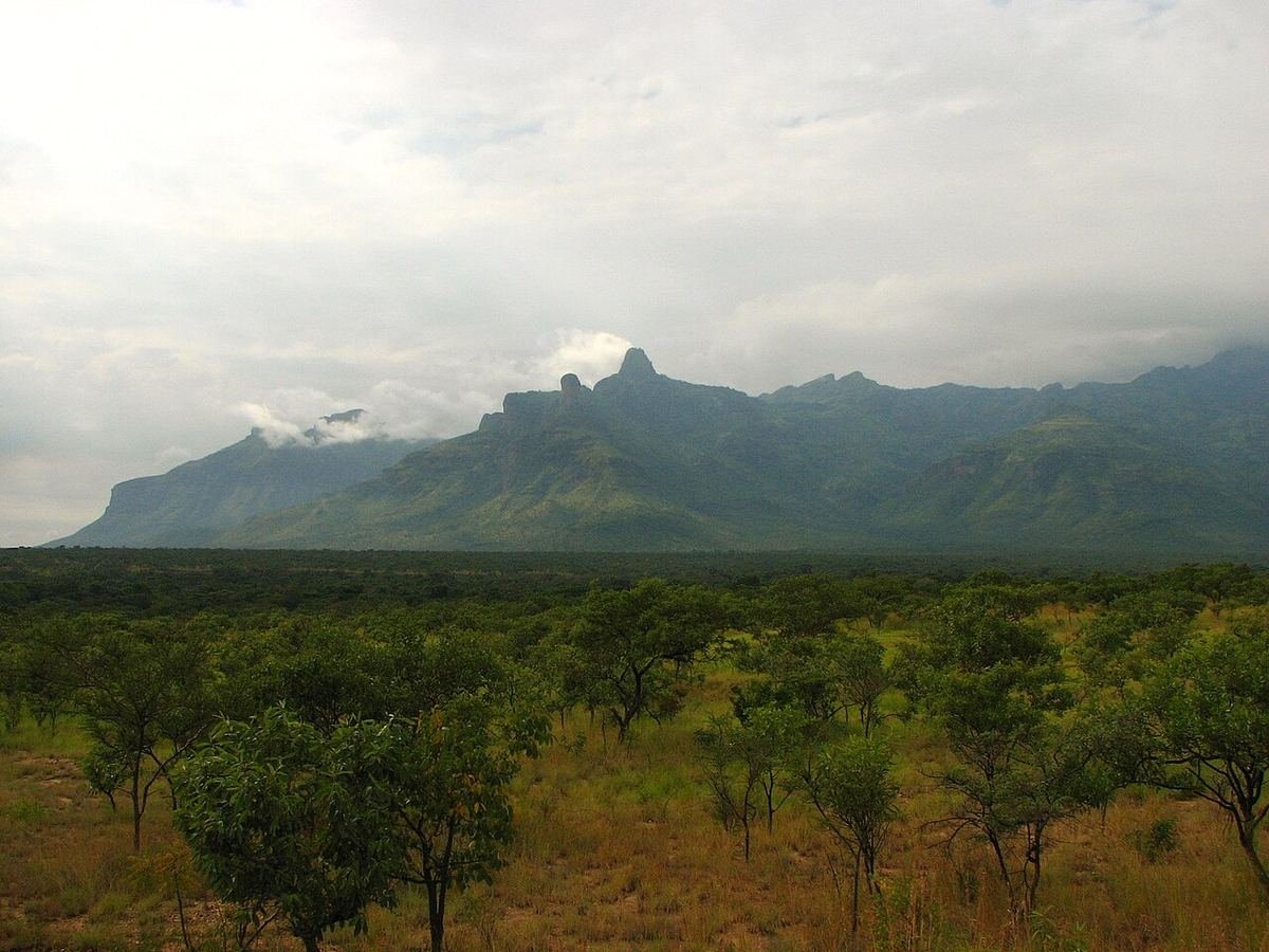
Most visitors to north-eastern Uganda fly straight into Kidepo and never see the rest of Karamoja. That’s a shame, because the region has some of the country’s most dramatic scenery, and Mount Moroto is the best way to understand it. Rising to 3,083 metres, it’s the highest mountain on the Karamoja plateau, an old volcano whose cliffs and forested ridges tower over the town of Moroto and the plains towards Kenya’s Turkana.
What the hiking is like
Mount Moroto is a hiker’s mountain, not a climber’s. There are no ropes or technical sections, but the paths are rough, steep and rocky in places, and you’ll be walking with local guides who know the routes and the villages along the way.
- Half-day and day hikes: walks onto the lower slopes and ridges above Moroto town give sweeping views over the plains, and suit anyone reasonably fit.
- The summit: reaching the highest point is a long, hard day. Hikers who have done it describe starting from around 1,400 metres near Moroto town, climbing through boulder fields and forest onto steep ridges, and being out for well over ten hours. Many people prefer to split it with a night camping on the mountain.
- Scenery: dry bush at the base, patches of montane forest higher up, and huge views over a landscape that feels very different from green southern Uganda.
The Tepeth people
The mountain’s slopes are home to the Tepeth, also called the So, a small community distinct from the Karamojong herders on the plains. The Tepeth are believed to be among the oldest inhabitants of the area, and they moved up onto the mountain generations ago. They were once mainly hunters and gatherers, and today they farm sorghum and millet and keep livestock.
Walking through Tepeth villages is one of the real rewards of a Moroto hike. We work with local guides from the community, which means your fees go to the people whose home you’re walking through. Always ask before taking photographs.
Moroto town
Moroto is Karamoja’s main town and the natural base for the mountain. It has a small airstrip, simple hotels and lodges, and a lively market where Karamojong herders come to trade. It also gives access to the Matheniko and Bokora wildlife reserves, and to other peaks such as Mount Napak (2,538 m) and Mount Kadam (3,063 m).
Combining Moroto with Kidepo
Moroto fits beautifully into a longer north-eastern trip. A classic route is:
- Sipi Falls or Mbale: break the journey from Kampala with a night on Mount Elgon’s slopes. See our Sipi Falls guide.
- Moroto: two nights for a hike and a cultural visit.
- Kidepo Valley: continue north by road through Karamoja to Kidepo Valley National Park for three nights of game drives, then fly back to Entebbe.
Driving one way and flying the other saves time while still letting you see the landscapes in between.
Practical tips
- Best time: the drier months, roughly November to March, give firmer paths. Start early to avoid the midday heat.
- What to bring: good boots, plenty of water, sun protection, a warm layer for the top and snacks for a long day.
- Fitness: the summit day is demanding. If you’re unsure, choose a shorter ridge walk and still enjoy the views.
- Safety: Karamoja is much calmer than it once was, but conditions can change. We check the latest situation with local partners and government travel advice before every trip, and we always hike with local guides.
- Roads: Moroto is a long day’s drive from Kampala, so we usually break the journey.
Is it for you?
If you enjoy wild places, big skies and meeting people whose way of life is very different from your own, Mount Moroto is one of Uganda’s most memorable experiences. Browse our mountaineering experiences, then get in touch and we’ll put together a Karamoja route with the right mix of hiking, culture and wildlife.
Found this useful? Send it to someone planning a trip.