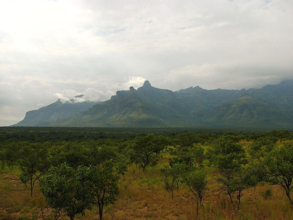
The Rwenzoris are not like other African mountains. There’s no road up and no easy path, just days of moss forest, bogs, giant plants and, near the top, glaciers almost on the Equator. The ancient Greeks wrote of the “Mountains of the Moon” as the source of the Nile. Today they’re one of Africa’s great adventures, for walkers who don’t mind getting wet.
The key facts
- Highest point: Margherita Peak on Mount Stanley, 5,109 m. It’s the third-highest point in Africa, after Kilimanjaro and Mount Kenya.
- First ascent: 1906, by an expedition led by the Duke of the Abruzzi. The peak is named after Queen Margherita of Italy.
- Protection: Rwenzori Mountains National Park covers nearly 1,000 km² and has been a UNESCO World Heritage Site since 1994.
- Gateway: Kasese, in western Uganda, about seven to eight hours by road from Kampala, or reached by flight.
Two routes to the top
The Central Circuit starts at Nyakalengija, near Kasese, and is run by Rwenzori Mountaineering Services. It’s the classic loop, climbing through the Bujuku valley, past lakes and giant lobelias, with camps at Nyabitaba, John Matte, Bujuku, Elena, Kitandara and Guy Yeoman. The summit is climbed from Elena camp. It’s steep and famously boggy, and completely unforgettable.
The Kilembe route climbs from the south, from Kilembe near Kasese, and is run by Rwenzori Trekking Services. It’s longer and climbs more gradually through beautiful valleys, which many climbers find helps with acclimatisation. It has well-built huts.
Most summit climbs on either route take around seven to nine days. The exact length depends on the route, your pace and how many rest days you want. Both operators work under the Uganda Wildlife Authority. We’ll confirm the current package prices when we quote your trip.
Not after the summit?
You don’t have to climb to 5,109 m to enjoy the Rwenzoris. Shorter treks of two to four days reach the lower camps and the incredible Afro-alpine plants. There are also day hikes in the foothills and cultural walks with the Bakonzo people, who live on the lower slopes.
How hard is it?
Hard, but not technical until the top. The lower days are long, wet walks with a lot of mud. The final push to Margherita crosses glacier and snow, so you’ll need ropes, crampons and a harness, with experienced guides. Altitude is a real factor above about 4,000 m, so take your time. Good fitness, strong knees and a positive attitude to wet feet matter more than climbing experience.
What to pack
- Rubber boots (wellies) for the bogs on the lower days. Many climbers find them better than hiking boots there.
- Warm, waterproof mountain boots that fit crampons, for the summit.
- A good waterproof jacket and trousers, and gaiters.
- Warm layers, a hat and gloves. Nights near the top drop below freezing.
- A warm sleeping bag, head torch and spare batteries.
- Dry bags for everything. Things get wet.
- Technical equipment (harness, helmet, crampons and ice axe) is often available through the operators. We check this for you.
When to go
The best months are late December to February and June to August. Even then, expect rain, mist and mud. The Rwenzoris are one of the wettest mountain ranges in Africa, and that’s part of why they’re so green.
Good to know
- The glaciers have shrunk a lot in recent decades. If you want to walk on equatorial ice, don’t leave it too long.
- Make sure your travel insurance covers high-altitude trekking and evacuation.
- Combine your climb with chimps in Kibale or game drives in Queen Elizabeth. Both are close to Kasese.
- See all our mountaineering experiences.
The Rwenzoris reward people who come prepared. Tell us about your experience and fitness, and we’ll help you choose the right route and length, and look after everything from Kampala to the trailhead.
Found this useful? Send it to someone planning a trip.